Vegetation Qulality Index#
Vegetation plays a key role in preventing desertification by providing shelter against wind and water erosion. Plant cover promotes infiltration of water and reduces runoff, residual plant materials from senescent vegetation enriches the soil with organic matter which improves its structure and cohesion . The preliminary classification and the assigned scores of the vegetation characteristics is as summarized in the table below:
Sensor/Dataset |
Temporal |
Spatial |
Extent |
License |
|---|---|---|---|---|
1992-2018 |
300 m |
Global |
||
2013-present |
100 m |
Global |
Public Domain |
Compute and download PROBAV maxNDVI form Google Earth Engine#
To compute and download PROBAV maximum NDVI composite from google earth engine. Open the Google Earth Engine Code and paste the lines of code provided below
 1 //Import the Proba-V data and North Africa region geometry
 2
 3 var imageCollection = ee.ImageCollection("VITO/PROBAV/C1/S1_TOC_100M"),
 4 table2 = ee.FeatureCollection("users/derickongeri/NorthAfrica");
 5
 6 //filet the image collection by year, compute the maximum NDVI, and clip to the study area
 7 var filteredCollection = imageCollection.filterDate('2018-01-01','2019-01-01')
 8                                         .max()
 9                                         .clip(table2);
10
11 var ndviImage = filteredCollection.select('NDVI');
12
13 Map.addLayer(ndviImage.randomVisualizer());
14
15 //Export the data to drive
16 Export.image.toDrive({
17   image: ndviImage,
18   description: 'NDVI_Max_2018',
19   maxPixels: 1e13,
20   scale: 100,
21   region: table2
22 })
Data Preprocessing in Qgis#
Open the cliped landcover data(all 36 classes) and the ProbaV maximum NDVI composite data on Qgis
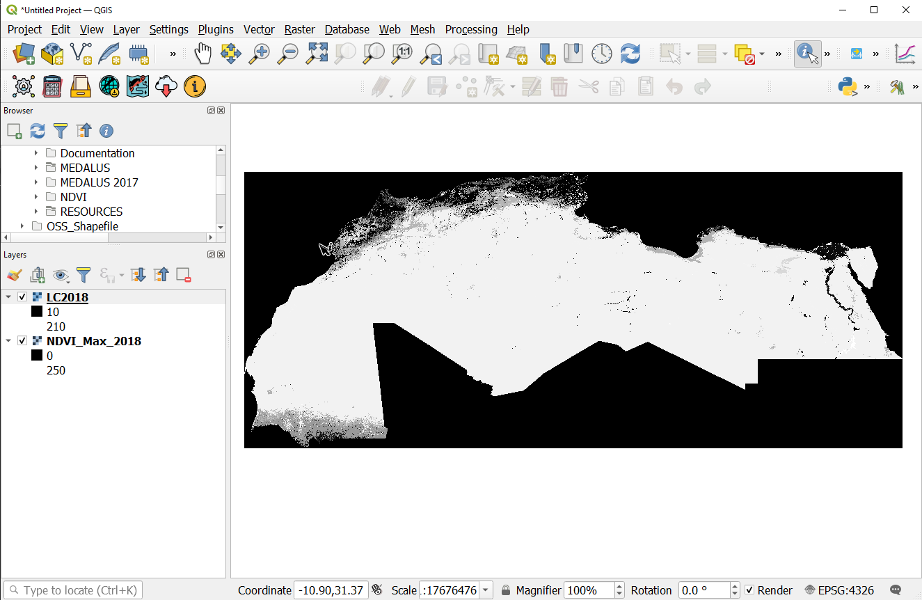
Landcover data and NDVI data loaded to Qgis#
Once the layers are loaded on to Qgis, open the processing toolbox and search for ‘Vegetation Quality Index’ in the search bar. The vegetatioon quality index model should show up under the Models section as shown. Click on the Model to open it.
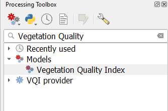
Vegetation Quality Index processing Model#
On the Vegetation Quality Index dialog that pops up, select the loaded landcover and NDVI data as inputs and run the model
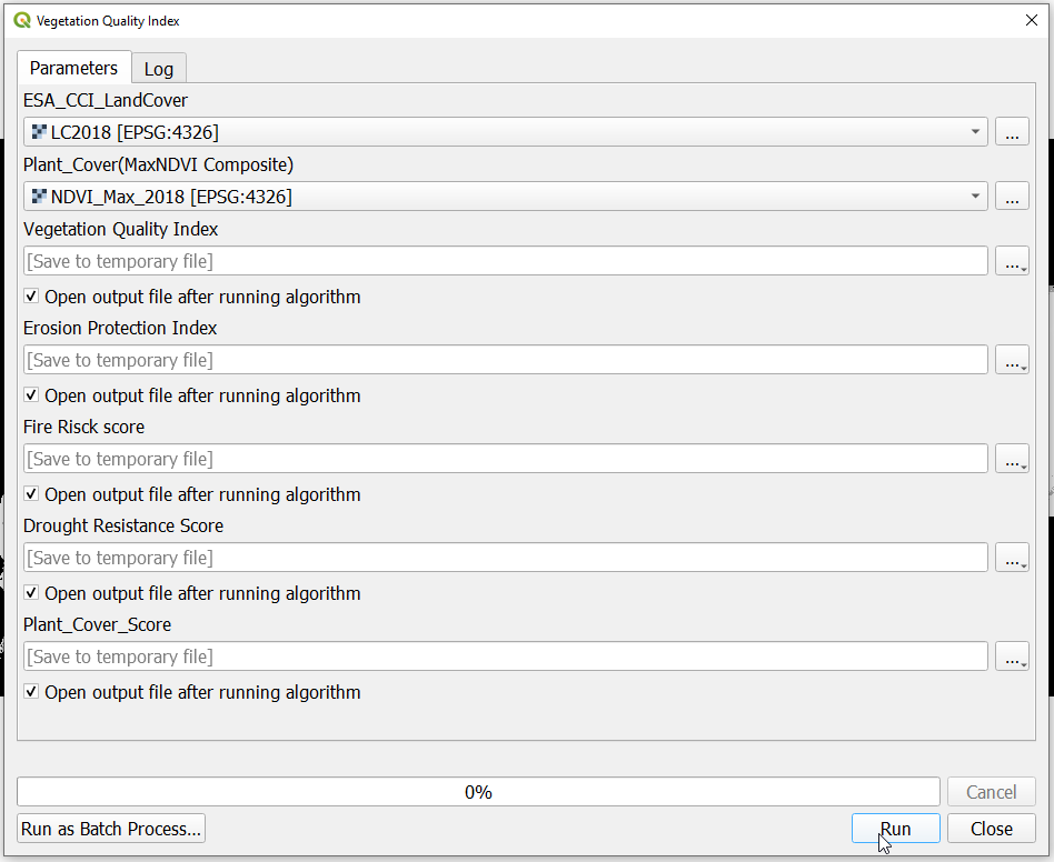
Vegetation Qulity Index inputs#
Note
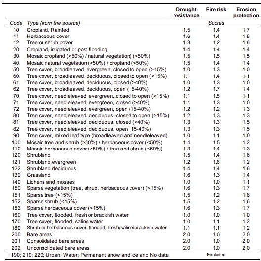
The vegetation Quality Index model Reclassifies the landcover and assigns scores to the landcover groups for the Fire Risk, Erosion Protection and the Drought resistance. The plant cover is derived from the Maximum NDVI composite as summarized in the graphical model below.

Vegetation Qulity Index inputs#
The scores to the reclassified landcover outputs and plant cover scores are assigned according to the table below: Ferrara, Agostino, et al. “Updating the MEDALUS‐ESA Framework for Worldwide Land Degradation and Desertification Assessment.” Land Degradation & Development 31.12 (2020): 1593-1607.
Vegetation Qulity Index inputs#
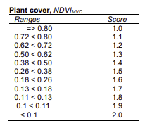
Plant cover scores#
On running the model the ouputs for the elementary VQI variables should be loaded onto QGIS as temporary layers. Save the layers to your desired folder with the appropriate descriptive name.
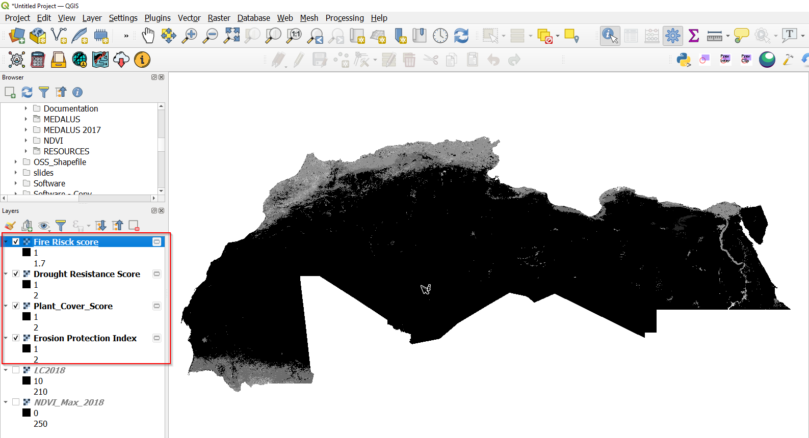
Vegetation Qulity Index model outputs#
Note
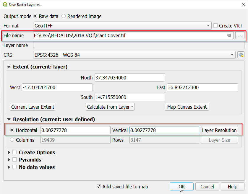
To save the layers with the appropriate dimensions, right click on the layer you want to save and navigate to Export>*Save as* and on the Save as dialog set the appropriate name and location for the output. Make sure to set the horizontal and vertical resolution option to 0.00277778 for all the outputs as shown below.
Vegetation Qulity Index model outputs#